By Rich
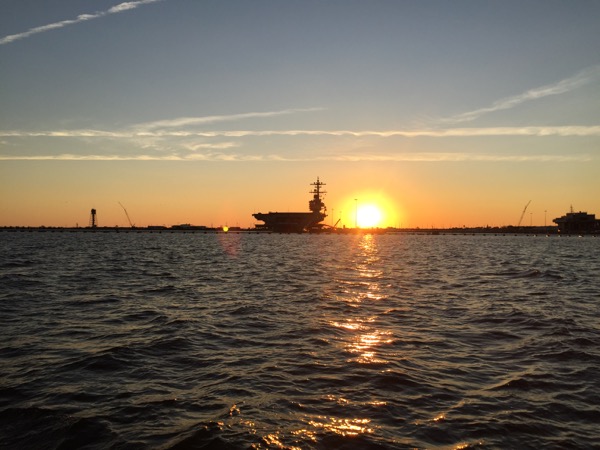
For those heading down “The Ditch” from the Chesapeake, the intracoastal waterway really begins with a passage through Norfolk Virginia. Here travelers will enjoy the awesome spectacle of our nation’s Navy warships. I got an extra treat by enjoying a sunrise timed just perfectly as a backdrop to my photos.
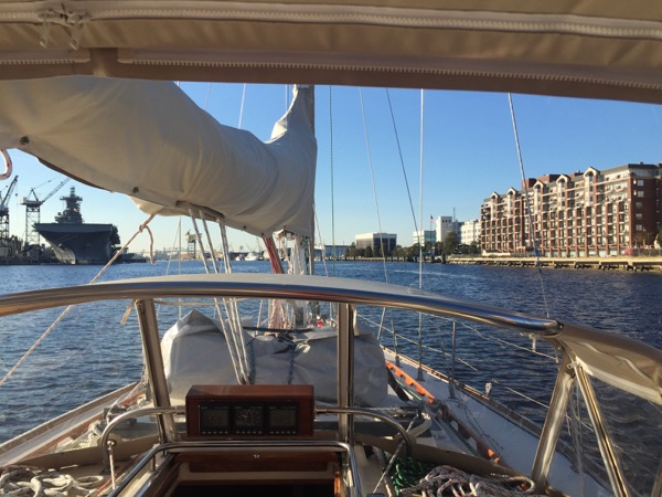
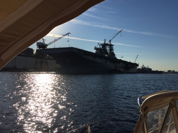
Heading further south, the Navy presence begins to lighten somewhat (though not over the VHF!!) and just as you pass the battleship Wisconsin, you pass mile marker “0” and it’s on – you’ve just started down the Intracoastal waterway south!
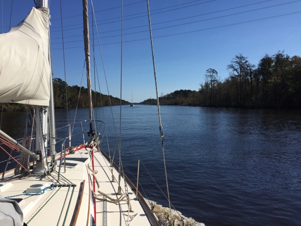
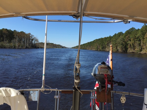
The ICW narrows noticeably soon after, and it was only as I entered this part of the journey that I suddenly found myself wishing I had crew. The morning was crisp and cool and a tailwind brought the very strong smell of bacon being cooked on the boat behind me. OH! To have had company on the boat to cook a hot breakfast while I stood a wheel watch. I was very jealous of that red little French sailboat.
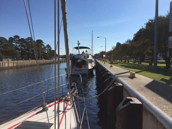
Soon after I was to learn just how busy the ICW can be for the helmsman. In this section there were many turns and plenty of traffic, which afforded almost no opportunities to leave the helm and go below for a potty break or to get a snack. About the best I could do was to hide from the cold under the dodger and use the remote VHF and auto pilot controls in the straighter sections of the Ditch to Coinjock, of which there were few.
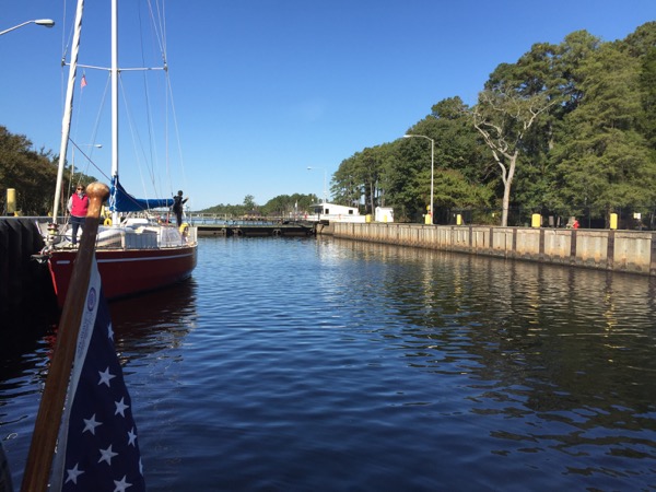
It was during this leg that I encountered the one and only lock to transit during my journey, which was an easy process once I got the hang of what the (very cranky) lock tender wanted me to do.
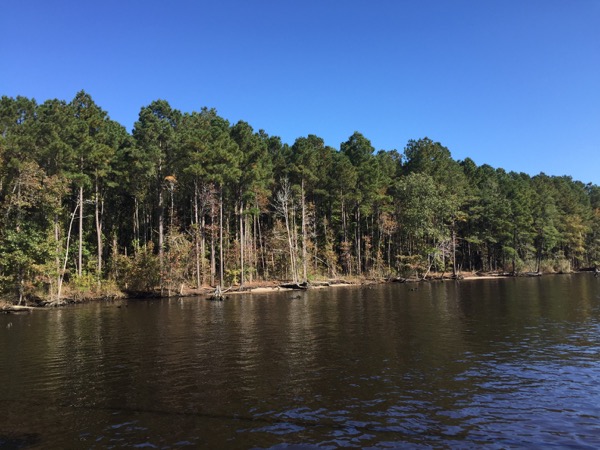
The balance of the passage was very scenic and and very busy. I got the first and one of the worst grounding scares of the trip on this passage just north of Coinjock itself. I would later hear that many boats ground on the spot that nearly got me, with a healthy potion needing a tow to get off. Whew!
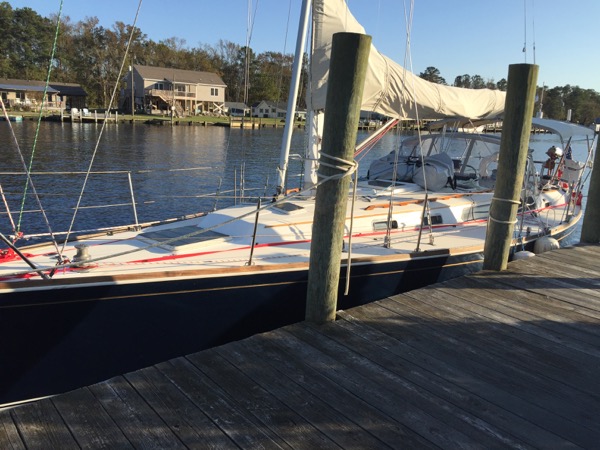
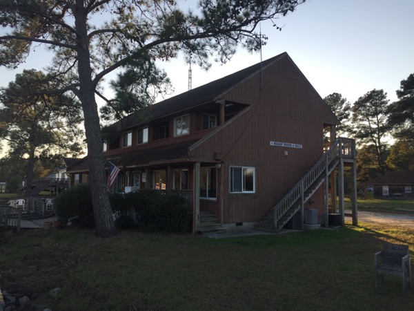
There are two marinas at Coinjock: Midway Marina on the west side of the Ditch and Coinjock Marina on the east. Pro tip: if you want to get dinner or provision at this stop, choose Coinjock Marina and not Midway. Midway offers only a dock, a friendly handshake and shore power. It’s a hike to get from Midway to anything useful, with no local taxi or Uber service available. We relied on rides from a local live-aboard and bartered wine and IT help as cab fare.
A successful if busy and mildly stressful start to my voyage down the ICW!

Hey Rich, a few questions. On your grounding scare, was it a charting issue. So shoaling not shown? How is your new wifi / 3G / 4G system working? Mostly 3G for you or are you finding the wifi useful? Is it needed or would the phone work fine? We finally made the decision to add the Kato arch this winter so I have the opportunity to rearrange my antenna farm and add if I want so I am thinking through comma issues
In this case, as in all of my grounding scares, the charts do not give accurate depths where shoaling has occurred. Your best friend on earth in all cases is to use Active Captain which will warn you of the danger spots. I navigate using Garmin Blue Chart and the Active Captain overlay will leave a symbol where the problem spots are. So as you move down the ICW you check each Active Captain caution symbol and read through the user notes. But they of course are purely anecdotal that there are problem areas; the shoaling by nature changes day to day. So you just slow down in those areas and feel your way through. Incidentally I have met more and more people who have had problems. One couple is on their way down now on a Sabre 38 power boat and they have been stopped dead twice because it was too shallow to travel, so the real pro tip here may really be to only travel at high tide! I met a very knowledgable owner on my travels who grounded a Panda 40 (draws just under 6) three times and needed a tow off once before he bailed out and went the balance of the trip outside of the ICW. I’ll post a separate comment on the 4G system.
Regarding the 4G system, I installed Wiire Pro before I left. For readers not familiar with the system, it creates a local wifi for your yacht, and then give you internet in one of two days (chosen by you): it can use a SIM card and get 3G or 4G where you have coverage or, at your election, you can connect to any wifi you come across (for example at a marina) and the Wirie then allows every user on the local WIfi to share that internet.
We are happy with the system. We chose T-Mobile for our SIM card which wasn’t a good choice. There is a conflict between T-Mobile’s 4G signal and our firmware that caused the system to have lots of problems, so here in Florida I am down to 3G until I change SIM cards and / or T-Mobile fixes the issue. The biggest benefit of the system as you travel is having a single wifi system on the boat, so you only have to connect to a marina’s wifi (for example) one time, and then every device gets the signal. It also allows us to use the mobile app for our AIS transponder including the anchor watch, which is huge for us. I would strongly recommend the system. It’s not perfect; one issue we face is working around signal interference caused by strong wifi signal in certain marinas, but I work around that by changing our wifi channel and / or upper our transmit signal. The one time we needed it (for the T-Mobile issue) , the Wirie Pro support was excellent.
I hope all of that helps!
Very interesting read! So, a question, are there many (any) stretches of the ditch that offer depths of 10 feet or more?
Sure! The thing about the ICW is that it is in part a literal thing – a “ditch” cut out of swamps, for example. But in other portions, the ICW is merely a route through an existing body of water like a bay. In fact, the Chesapeake itself is part of the ICW. For the bodies of water we travelled, we say mostly depths around 10 -15 feet as the intended depth of the parts that were dug, but obviously where shoaling was encountered we saw a lot less!